Jump onboard for the upcoming International Space Station EarthKAM opportunity. Middle years schooling is an ideal area to incorporate space science, geography and some juicy maths. Students upload photo requests to the remote camera onboard the ISS. The images are then made available for student investigation and analysis.
Category Archives: GPS, Geocaching, Google Earth
Schools Exploring Environments -SEE
MacICT is looking for schools (yrs 4-10) keen to trial our new Environment Education project focused on local school habitats.
Schools Exploring Environments takes a collaborative student centred inquiry approach with teacher moderation and guidance. Students work through online modules such as habitat health voting, Google maps locator, data wikis, image galleries etc along with data collection/surveys in the field. Schools will be supported by email, phone and video conferencing during term2.
Schoolscache Update – GPS/Geocaching
Back in April 2010 my then class placed a travel bug -TB in a cache outside the school boundary. The TB ( an individual trackable item) had a goal to get to Birdsedge First School and our partner class near Huddersfield, England. Over the course of the year the class was also able to observe via Google Earth and Google Maps the progress ( and sometimes lack of) as fellow cachers physically found and moved the TB to the next cache on the global journey. In late December the TB was retrieved from Birdsedge School cache and the journey was complete. A real success for both schools.
So what did the students experience and learn.
1. Through the use of Google Earth students have engaged with world geography as the TB travelled through NSW to the UK and through nine or so cache locations. At each stop the class discussed location, geography, travel and reflected on distances travelled.
2. Geocaching and sending TBs on a mission relies on other people helping to achieve the goal. If it wasn’t for fellow cachers moving the bug on we would never have reached Birdsedge. A great opportunity for learning about teamwork, personal goals and human nature.
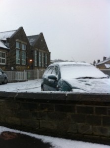
3. Opportunities for international collaboration and understanding are very evident. Students can email or share a blog with their partner school and compare similarities and differences. For my class, seeing photos of Birdsedge and the cache under heavy snow while we sweltered through a hot summer highlighted seasonal change and the opposing seasons.
4. We lost a TB on its return journey from the UK and also have another that started in the UK, reached the US and was then returned to Europe… it’s still there!
Additionally the use of the Garmin GPS receivers has allowed the stage 2 students to move from orienteering styled mapping activities to hiding and finding caches within the school grounds. In teams students communicate, share and explore their local environment using GPS technologies to navigate and measure.
More to come…
EarthKAM Jan 18-21 2011
After a few delays and cancellations a new Earthkam mission is open for registration. Have your students jump (virtually of course) on board the ISS and take images of earth from the onboard digital camera.
This offers a great opportunity for math education as students need to identify appropriate orbits and the latitude and longitude to get a photo of their desired location.
Check it out here – EarthKAM
Schoolscache 2010
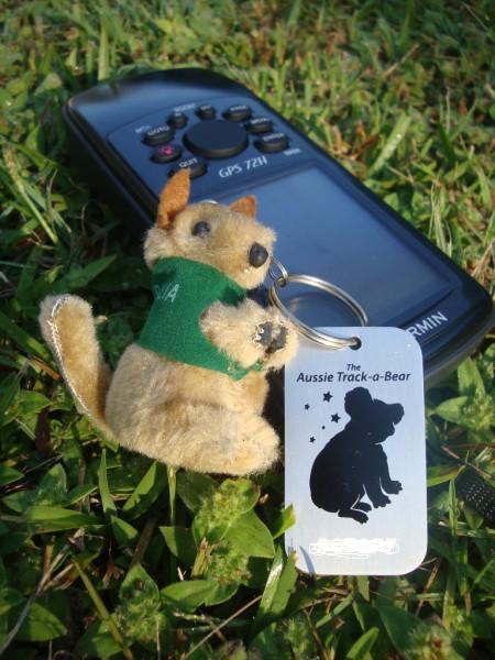
Over the last few months I’ve been exploring the potential of GPS technology in the primary schools environment. Incorporating elements of science and especially spatial maths and position in a fun way, the use of handheld GPS is a new tool to support learning. One only needs to look at the global interest in geocaching to see the positive integration of GPS use into mainstream recreation. I’ve been using a couple of Garmin GPS 72 units which are cost effective and easy to use as all buttons are on the front of the unit ( an advantage over the cheaper etrex model), my students are raring to get out and find their way around mini-courses in our school.
To integrate this into the classroom our year 3 class has placed a geocache near the school and have released a trackable bear tag that we can follow on Google Earth as it journeys around the globe. I’ve set up a schoolscache project with schools in England, USA and Abu Dhabi. The aim will be for schools to observer their trackables on Google Earth and experience the physical journey of the tags as well as learning about the target schools, their students and cultures. I’ll provide updates as the project gathers momentum. The schools are collaborating via a private wiki to ensure student confidentiality.
It’s early days but again the integration of web2.0, Google Earth and GPS technologies are demonstrating how we might look at new ways and means of learning. Of course international sharing and partnerships are a wonderful result as well!
Google Earth KMZ
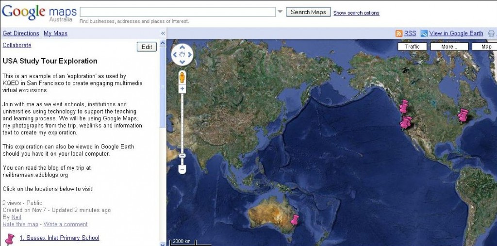
I’ve saved a link to a KMZ file of my USA Study Tour Exploration. You can see how easy it for students/classes to generate their own interactive journey.
View an ‘Exploration’
I have been using Google Maps to create an exploration of my trip. You can view it here and you can also view it in Google Earth if it is running on your local machine. I see great scope for explorations in the K-12 learning environment. These are based on the work of KQED in San Francisco.
View USA Study Tour Exploration in Google Maps.


